Gordons
Overview
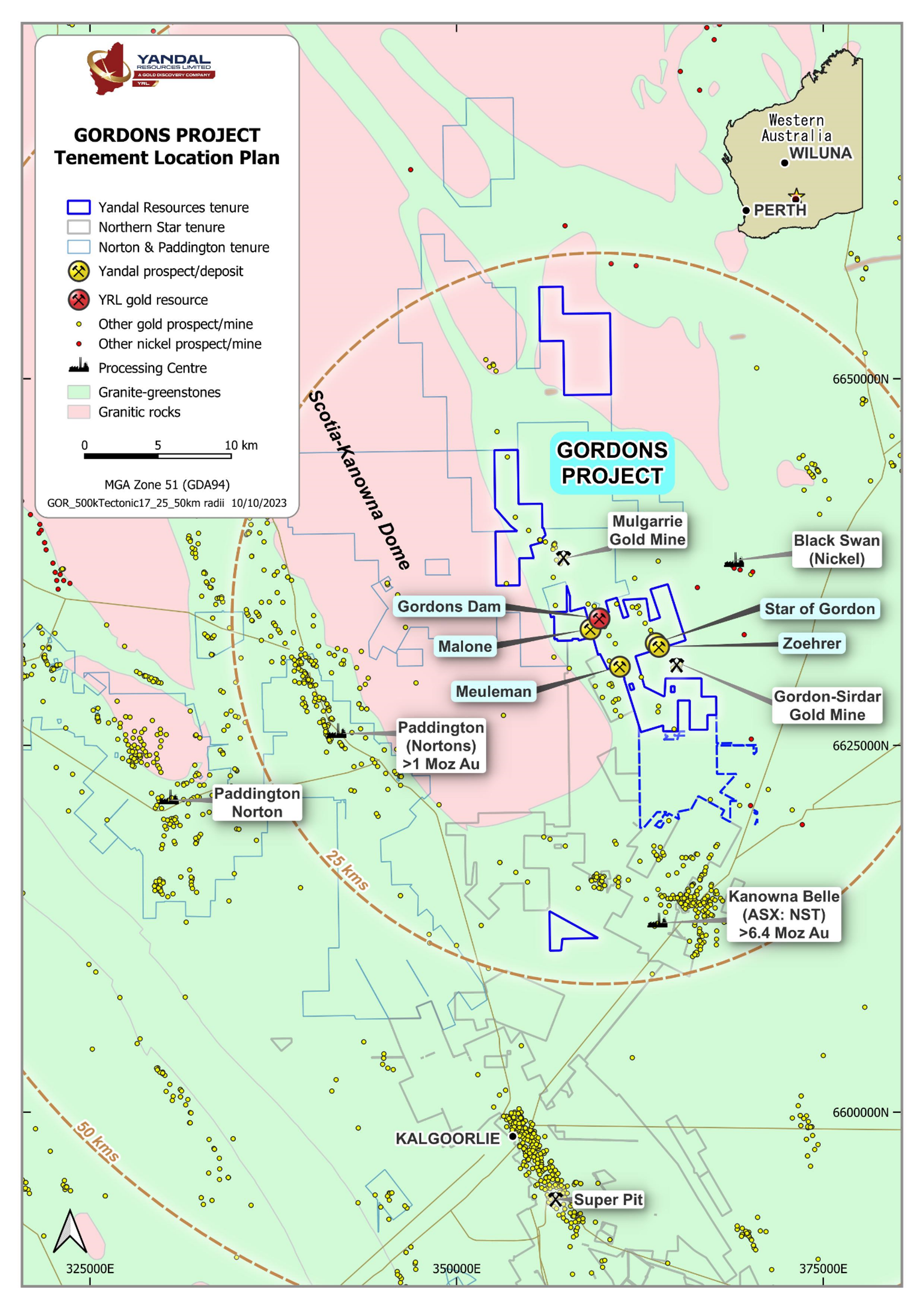
- 56 km² area located in a premier gold producing jurisdiction; 30km from Kalgoorlie
- Situated on the Eastern flank of the Scotia-Kanowna Dome; similar geological setting to Kanowna Belle (+6.4M Oz) and Paddington (+1Moz)
- Within haulage distance to multiple gold processing plants (Paddington, Kanowna Belle) and close to operating mines (Mulgarrie, Gordon-Sidar)
- 1.6km along strike from the Gordon-Sirdar underground mine
- Deep weathering/paleochannels -> poorly explored due to ineffective drilling
- Numerous gold occurrences/historic workings = fertile system
3D Modelling
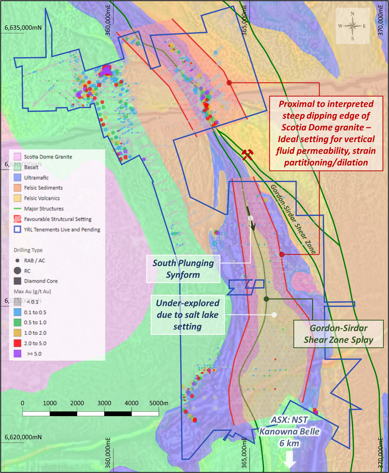
In Q1 2023 the Company completed a 3D goelogical modelling exercise to determine the broader structural and stratigraphic controls on mineralisation to guide and prioritise ongoing exploration. Though this work is ongoing, the outcomes and findings from the Phase 1 interpretation are:
- The delineation of the Gordon-Sirdar Shear Zone and associated splays (“GSSZ”), which extend through the Gordons Project tenure and are coincident with the Star of Gordon prospect.
- Recognition that the GSSZ is associated with a steepening of the eastern margin of the main Scotia-Kanowna Granite Dome. This geometry provides opportunities for enhanced fluid permeability and strain partitioning, making it an ideal location for targeting larger-scale gold mineralisation.
- The identification of a keel of mixed greenstones interpreted to be similar to the Kanowna Belle lithologies extending south of the Gordons Project (and within the recently acquired lease).
The GSSZ shear zone near the Star of Gordon prospect area remains a high-priority target. Further exploration will test the potential for plunging targets at depth.
Gordons Dam
- Paleochannel, laterite and bedrock gold deposit
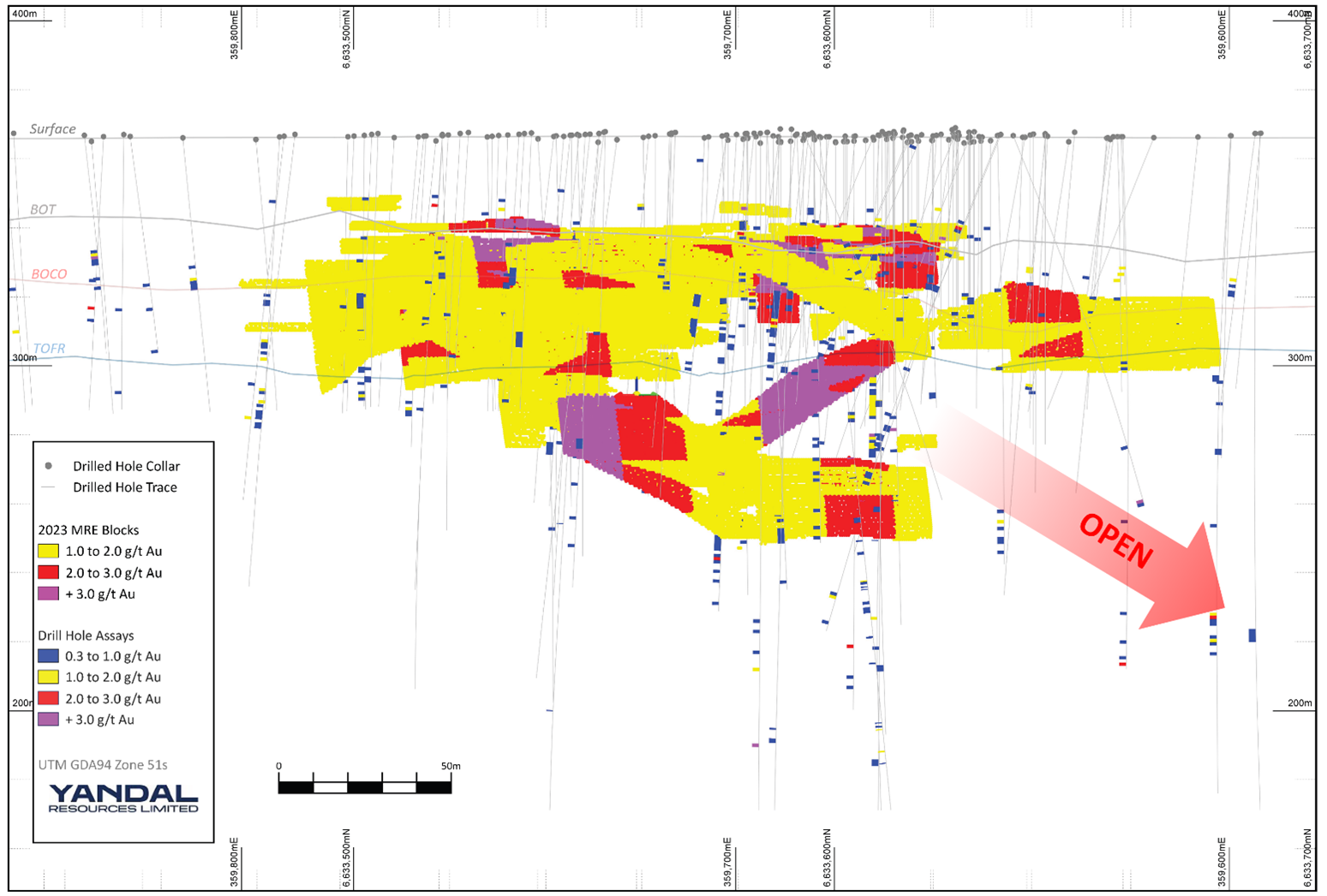
- Inferred Mineral Resource Estimate (“MRE”) for Gordons Dam deposit of 365,000t @ 1.7g/t Au for 20,000oz reported above 1.0g/t Au lower cut-off grade.
- MRE defined to a maximum vertical depth of 120m; mineralisation remains open at depth.
- Gordons Dam deposit located on granted mining lease approximately 35km NNE of Kalgoorlie, close to haulage infrastructure and operating mines at Gordon Sirdar and Mulgarrie.
- Recent 3D geological modelling indicates that intrusive unit controlling primary mineralisation plunges to the north and remains open.
Malone
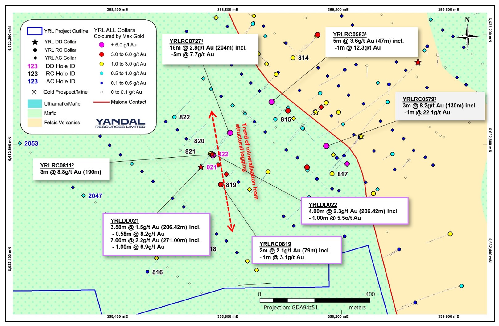
- Gold related to felsic – mafic contact
- 600m trend of high-grade intercepts
- Recent RC and DDH drilling has returned high-grades 300m east of ‘Kink Zone’
-
- 3m @ 8.2g/t Au including 1m @ 22.0g/t from 130m
- 16m @ 2.8g/t Au including 5m @ 7.7g/t from 210m
- 3m @ 8.8g/t Au including 1m @ 9.4g/t from 190m
- 7m @ 2.2g/t Au including 1m @ 6.9g/t from 271m
-
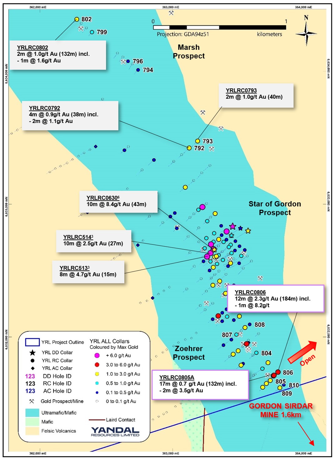
Star of Gordon
- 2km north of the Gordon Sirdar gold mine
- Mineralisation occurs within a mafic package intruded by porphyry and dolerite rocks
- Associated with sulphides, quartz veins and shearing
- Intercepts include:
-
- 10m @ 8.4g/t Au from 43m & 1m @ 52.5g/t from 51m
- 8m @ 4.7g/t Au including 1m @ 13.3g/t from 19m
- 4.41m @ 4.8g/t Au incl. 0.44m @ 46.4gt/t (227m)
-
Stay in the loop
Subscribe to receive announcements and updates to your inbox


